
In the world of data science, spatial data science is at the core of helping to solve problems that pose a threat to the planet, such as deciding where to install solar parks, constructing resilient cities, forecasting crop yields, population density analysis for disease or immunization mapping, and more. Spatial data science combines the phrases data science and spatial, which is geospatial; merging the two can address a variety of business issues.
Spatial analysis, commonly referred to as geospatial data science is a geographical solution that combines data science with geographic solutions like geographic information systems (GIS).In simple terms, Geospatial data science is one of the emerging elements of data science that consists of satellite imagery, location analytics, remote sensing, and raster and vector data in a GIS and protection system. We apply Geospatial analytics techniques to gather insights from spatial datasets. For example, Suppose the government wants to know which crops may grow in a specific location to help farmers create extra income and more efficient harvesting procedures. In that case, they can find these answers by leveraging spatial data science methodologies and geospatial technology. A few geospatial technology applications that utilize the spatial data science to help billions of customers are Google maps, Weather maps, real estate listings, transmutability, and surveillance.
What Motivates Data Scientists to Value Spatial Data Science?
Data scientists are aware that the returns will be worth the effort even though spatial data science is a field that has to be completely studied. In general data science, there is much to learn and apply, especially given how quickly the world is changing. Industries all across the world have benefited from the sophisticated methodologies that modern data science has already developed. Organizations can improve the procedures required to acquire and evaluate data, such as lead generation, consumer market behavior, and other market trends, thanks to this expertise and technologies. Simply said, spatial scientific data may help with resource management, software development, geodata dissemination, and many other very effective, transportable, and useful solutions.
You can be more creative with spatial data because it is thought to be more intuitive. Using a user-friendly spatial data platform.
Spatial analysis includes any formal technique that studies entities using topological, geometric, or geographic properties. This specialized form of research allows you to understand coordinate and projection systems, geometric functions, and more. The spatial analysis will enable you to solve complex location problems and better understand what is happening in your world. Spatial analysis lends a new perspective to your decision-making.
Spatial analysis can be used for:
- Finding patterns, clusters, and hotspots
- Location optimization, such as site selection
- The study of the interaction between functions and why they occur
- Using exploratory analysis to find relationships between variables
- Position-based feature modeling involves simulation and prediction
- Mapping and visualization applications
Only one in three data scientists claim to be specialist in geographical analysis, indicating that there are still very few spatial data scientists. Generally, five key steps comprise the standard workflow for spatial data scientists, which takes them from data collection to offering business insights after the process. The five Steps are:
- Data ingestion & Management
- Data Enrichment
- Analysis
- Data Visualization and Solution
- Integration

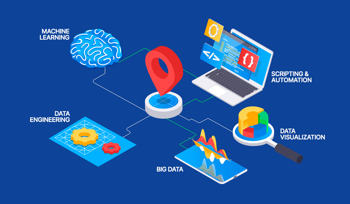
Here we are exploring elements of spatial data science:
1. Data Engineering
Data generation, storage, maintenance, usage, and distribution are all managed by the computer science field known as data engineering. Big data processing is aided by using computer languages like Python, SQL, and R.
For analysis, data are prepared by data scientists. They add fields, fill missing values, geo-enrich, and clean values, for instance. Data engineering and the required ETL workflow usually come first in a pipeline for data science.
2. Data exploration and visualization
Data exploration and visualization are one of the most important aspects of data science. It systematically examines the raw data to have a better understanding and thus make better-informed decisions. It is an essential part of the process of understanding data which helps data scientists quickly identify patterns and relationships, which can help us extract information from big data. You can also use visualization techniques to verify and make sure it makes sense.
The data visualization process is a continuous and iterative process that continues from start to finish. Before moving towards a solution, it improves data understanding and pattern recognition and guides data scientists towards better model development by helping them understand limitations or better opportunities. It enables you to define a blueprint for how to proceed towards a solution. Finally, you can tell a story about your data and share it with your audience.
3. Spatial analysis
GIS is all about spatial analysis. The spatial analysis explains where objects are, how they relate to one another, and how they are related. It can be used for site selection, space-time analysis, or predictive modeling. Spatial analysis is a tool for analyzing the distribution of individuals or any other feature in a geographic location. By measuring, quantifying, and comprehending our surroundings, you may find solutions to location-based challenges.
4 Machine learning and AI
Machine learning and artificial intelligence are only two more tools for geographical analysis.
Machine learning speeds up any process by evaluating massive volumes of data without requiring human participation. For instance, using data, you may produce an accurate land cover by simply training a machine learning model.
Machine learning is a means to automate deriving insights from your data, from big data analysis to clustering. Machine learning is increasingly becoming a necessary component of every workflow due to the growing quantity of data businesses gather, store, and evaluate.
5. Big Data Analytics
Big data analytics has revolutionized many industries like no other. It is widely used in industries or work such as transportation, marketing, and retail. The tech world has been using big data analytics for years. But as the world becomes increasingly digitized, it becomes more critical. Big data analysis refers to the study of large volumes of data.
Although big data falls under the category of spatial analysis, the main idea is that you are analyzing it at a large volume. Spatial data, whether it be in the form of points, lines, polygons, or rasters, big data will be a beneficial tool in data science.
6. Modeling and scripting
Automation has been used for a very long time to eliminate manual labor. It saves us time and establishes a predictable workflow, enabling us to concentrate on more crucial duties with less effort.
A typical data science process automatically integrates everything from analytics to data engineering. You may then replicate the process and create an autonomous system.
ETL, or extract, load, and transform, plays a significant role after the analytics services are operational. It need not be a daily operation; it might be a weekly, monthly, or annual business activity.
The most widely used programming languages in this area are Python and R. Some in the community claim that R still has a more comprehensive selection of specific geospatial libraries. Python’s main data science libraries are more centralized and organized. Geopandas, QGIS, PostGIS, CARTOframes, and Esri are additional essential tools

Spatial data science has a wide variety of use cases, and some of them are:
- The spatial data analysis method is used to understand how cities grow by tracking the growth of buildings and infrastructure.
- Experts can assign risk scores to areas for planning and recovery in environmental disasters.
- Spatial scientists can track where nature declines by looking at forest area or lake area imagery over time.
- Spatial data analysis can be combined with health for disease outbreak monitoring and control.
- Leveraging GIS data science for location intelligence, surge pricing models, marketing, and recommendation systems.
- Merging spatial data and Landsat data with a Machine Learning model to predict crop yield.
The adaptability of spatial data science is what makes it so attractive. Any industry vertical of different sizes and forms can use it. The following are just a few of the many widespread spatial data science example in today’s world:
1. Spatial Planning
Geospatial data examine patterns of urban growth and expansion. When used correctly, it can reveal new areas for further development while considering several elements necessary for successful construction.
2. Agriculture
Geospatial technology is currently used to analyze soil data to determine which crops can grow in specific locations. It also helps farmers create more efficient harvesting practices. Food production has soared, and environmental standards have improved with the help of geospatial data.
3. Navigation
Geospatial data is used in web navigation maps to provide helpful information to the public. Web maps are regularly updated based on geospatial data and are widely used in everyday life.
4. Telecommunication
Telecommunications companies use geographical data to build and improve networks and track consumer requests and maintenance schedules. 5G mobile internet connectivity is being expanded using geospatial data.
5. Transportation
GIS can help with several transportation problems, such as identifying dangerous intersections, improving road optimization, and choosing the optimal location for a new road or rail network.
6. Planning and Community Development
Geospatial data helps us understand and respond to global issues. As GIS technology advances, the number of new uses in the planning sector is increasing. GIS tools can change thinking and behavior by integrating geographic intelligence into strategic planning.
7. Natural resource management
Forests can be adequately maintained and managed using geospatial data. It is vital for the allocation and regional distribution of water, which is an essential component of the environment.
8. Estimate flood damage
Governments use geospatial data to identify flood-prone areas and plan relief.
Spatial data analysis software or GIS software transforms spatial data into information that is slowly becoming the cornerstone of business strategies and organizational outlooks.
Here are the top 5 spatial data analysis software that can help you get the most out of your spatial data sets.
1. ArcGIS
ArcGIS is a prevalent GIS software part of the Esri Geospatial Cloud. Innovative mapping styles make it easy to create maps on the fly. A built-in analytics tool lets you extract insights from spatial data. GIS developers can use APIs and SDKs to connect data.
2. QGIS
QGIS enables automatic map creation and spatial data processing and boasts a highly interactive community. Community members design several QGIS plugins for community members. An unrivaled addition is a support in the form of QGIS Stack Exchange.
3. FalconView
FalconView specializes in displaying a wide range of sensory data. This includes satellite imagery, LiDAR, and digital elevation models (DEM). This software is often used for combat flight training programs and is very popular for defense and military applications.
4. GeoDa
GeoDa is an ideal tool for those new to spatial analysis. The device is primarily used for performing geostatistical analysis. Users can efficiently perform statistical functions such as regression analysis on spatial data to create exciting business and economic use cases.
5. Surfer
Surfer is a LiDAR analysis software. Surfer allows you to switch between 2D and 3D mapping modes. Surfer provides a simple UI/UX to help you navigate through layers smoothly.
Surfer is actively used in industries like Agriculture, Archaeology, Construction, Education, Energy, Environmental, Exploration, Geophysical, Geotechnical, Geothermal, GIS, Government, Maritime, Military, Mining, Mudlogging, Oil & Gas, Renewable Energy, UAV / UAS, Utilities, and Water Resources.
Spatial data science and technology is a fascinating area of data science that has applications in practically every industry, including resource monitoring, urban planning, healthcare, military, marketing, and social networking. Therefore, organisations that rely on the analysis of such vast data to make better operational and strategic decisions, including government agencies, non-governmental organisations, and companies like Facebook, Google, Uber, Digital Globe, and Orbital Insight, need geospatial data scientists. The subject of spatial data science will expand over the next few years, and with it, job prospects. Therefore, becoming knowledgeable in this area can expand both your skill set and your options for employment.